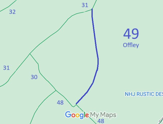
Annotated map reproduced courtesy of Googlemaps.
We need a volunteer to photograph this route for this year's Access and Riding Rights of Way Survey. It's easy - just take photographs (safely) when you use the path. Find out more!
| Paths Greenways Bridleways Tracks | ||
| PG: OBJECTS: PROMOTION: Offley 49 | ||
Annotated map reproduced courtesy of Googlemaps. |
This bridleway starts from Offley 48 bridleway and continues generally northeastwards then northwards to end on Offley 31 bridleway.
We need a volunteer to photograph this route for this year's Access and Riding Rights of Way Survey. It's easy - just take photographs (safely) when you use the path. Find out more! |
| Legal History |
Definitive Statement (4 Dec 2015)
Path: [Offley] 49. Status: Bridleway. Definitive Map sheet: 19 Commences from the junction with BR48 at TL 1465 2789 generally north eastwards and then northwards for approx 780m to the junction with BR31 at TL 1476 2864. Width: Varies between 8.5 and 11m as shown by the cross-hatching on the plan annexed to the Hertfordshire County Council (Offley 48 & 49) Modification Order 1995. Limitations: None |
© 2023 Patchetts Green Bridleways Trust. File reference: EC002. HCC reference: NH/39.