Paths Greenways Bridleways Tracks
 PG: OBJECTS: PROMOTION: Nettleden with Potten End 27
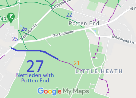
Map showing Nettleden bridleways
Annotated map reproduced courtesy of Googlemaps.

Photographs have been taken for the 2021 Access and Riding Rights of Way Survey. Check back soon for results! Find out more!

Legal History
20 Jun 1953: Nettleden with Potten End 27 was recorded as a bridleway on the original definitive map and statement. DM sheet DM3-20 (TL00NW).
31 Dec 1977: Nettleden with Potten End 27 was shown as a bridleway on the special review draft map and statement. DM sheet SR-65.
Definitive Statement (4 Dec 2015)
Path: [Nettleden with Potten End] 27.  Status: Bridleway.  Definitive Map sheet: 65
Commences at junction with county road at parish boundary N of Brackenhill thence generally E along parish boundary across county road and past Gutteridge Farm to junction with path 21 E of Moor Cottage.
Maintainability
This route is maintainable at the public expense because it was a footpath or bridleway existing before 30 Apr 1959.

© 2024 Patchetts Green Bridleways Trust.

Stats2