Paths Greenways Bridleways Tracks
 PG: OBJECTS: PROMOTION: Kelshall track off Church Lane
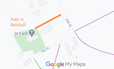
Map showing old route in Kelshall
Annotated map reproduced courtesy of Googlemaps.

This route starts from Church Lane (shown on the plan as 'The Street') and heads generally eastwards to the graveyard.
BHS As part of the British Horse Society's work to record paths before Path Extinguishment Day, this path was found on the historical mapping, and so an application was made to ensure it is not extinguished.

Legal History
18 Jan 2021: Application to record the old pathway. HCC reference NH/297.
Definitive Map sheet: 7

© 2024 Patchetts Green Bridleways Trust. File reference: EC1122