Legal History
1938: The route is shown as a green lane (green dots) on the Hertfordshire County Council
ROW survey.
Map Hitchin Rural West 1 .
1 Nov 1953: The route was recorded as a bridleway on the original definitive map and statement. DM sheet DM4-12.
31 Dec 1977: The route was shown as a bridleway on the special review draft map and statement. DM sheet SR-11.
17 Aug 2017: Application for restricted byway status. HCC reference NH/301.
| Path |
Application |
Certificate |
Direction |
Inv Report |
Order |
Confirmed |
| EC988 |
17 Aug 2017 NH/301 |
11 Sep 2017 |
|
|
|
|
|
Definitive Statement (4 Dec 2015)
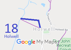
Path: [Holwell] 18. Status: Bridleway.
Definitive Map sheet: 11
Commence from county road NW of Church thence N and W to join BR10 (Shillington) at
county boundary. Known as Fakeswell Lane.
|
 As part of the British Horse Society's work to record paths before
Path Extinguishment Day,
it was spotted that Holwell 18 appeared to be an old road. As such, it appears to carry rights for horse drawn vehicles, and so an application was made to record the route as a restricted byway.
