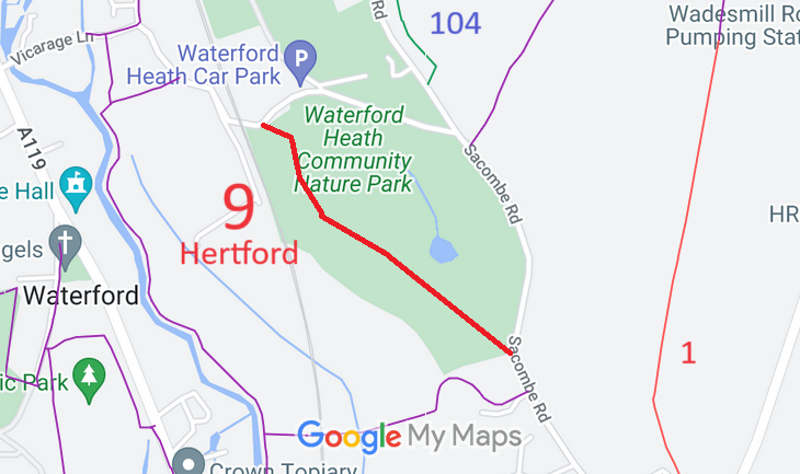
Annotated map reproduced courtesy of Googlemaps.
We need a volunteer to photograph this route for this year's Access and Riding Rights of Way Survey. It's easy - just take photographs (safely) when you use the path. Find out more!
| Paths Greenways Bridleways Tracks | ||
| PG: OBJECTS: PROMOTION: Hertford 9 RB | ||
Annotated map reproduced courtesy of Googlemaps. |
This route runs from Vicarage Lane to Sacombe Road.
We need a volunteer to photograph this route for this year's Access and Riding Rights of Way Survey. It's easy - just take photographs (safely) when you use the path. Find out more! |
| Legal History |
Definitive Statement (4 Dec 2015)
Path: [Hertford] 9. Status: Restricted Byway. Definitive Map sheet: 59 To Sacombe Road. Starts from Borough boundary where road crosses railway line to Waterford. First part of road made up with gravel to Grid Ref: TL3164 1491 then south south eastwards for approximately 100 metres to Grid Ref: TL3167 1481 thence in a south easterly direction for approximately 290 metres to Grid Ref: TL3191 1463 then diagonally across field, through field-gate into Sacombe Road. Width: 3 metres between Grid Ref: TL3164 1491 and TL3191 1463. |
© 2021 Patchetts Green Bridleways Trust.
