Paths Greenways Bridleways Tracks
 PG: OBJECTS: PROMOTION: Essendon 18 Hornbeam Lane
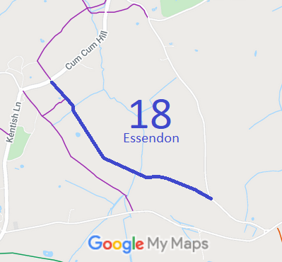
Map showing Essendon 18 bridleway
Annotated map reproduced courtesy of Googlemaps.

We need a volunteer to photograph this route for this year's Access and Riding Rights of Way Survey. It's easy - just take photographs (safely) when you use the path. Find out more!

Legal History
20 Jun 1953: The route was recorded as a bridleway on the original definitive map and statement. DM sheet DM3-25.
31 Dec 1977: The route was shown as a bridleway on the special review draft map and statement. DM sheet SR-70.
13 Mar 2013: Application to record as a restricted byway and add width. HCC reference W+H/92.
16 Dec 2025: Application made to the Secretary of State for a direction that Hertfordshire County Council determine the application by a set date. ROW/3376847.
22 Dec 2025: PINS write to Hertfordshire County Council and request a response by 2 Feb 26.
25 Feb 2026: Secretary of State directed Hertfordshire County Council to determine the application by 25 Aug 2026. PINS reference ROW/3376847.
Application Process
Path Application Certificate Direction Inv Report Order Confirmed
EC532 13 Mar 2013 W+H/92 2 Feb 2014 25 Feb 26 (6mo)      
Definitive Statement (4 Dec 2015)
Path: [Essendon] 18.  Status: Bridleway.  Definitive Map sheet: 70
Commences from Littleheath - Essendon Road opposite FP15 SE of Campfield Place thence SE known as Hornbeam Lane, to junction with county road at SE corner of Nine Acre Wood.
Maintainability
This route is maintainable at the public expense because it was a footpath or bridleway existing before 30 Apr 1959.

© 2025-26 Patchetts Green Bridleways Trust. File reference: EC532. HCC reference: W+H/92

Stats2