Legal History
1847: Ayot St Lawrence 8 BW was shown on the Ayot St Lawrence tithe map as not subject to an apportionment.
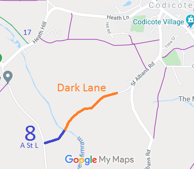
1938: Ayot St Lawrence 8 is shown as a BW (blue dots) and Dark Lane is shown as a class 3 road on the Hertfordshire County Council
ROW survey.
Map: Hitchin Rural West 18 (Herts 20 SW).
2 Feb 1953: Ayot St Lawrence 8 was recorded as a bridleway on the original (1953) definitive map and statement.
1 Nov 1953: Dark Lane was not recorded on the original definitive map and statement.
16 Mar 2015: Application made to record Dark Lane. HCC reference NH/269.
|
| Application Process |
| Path |
Application |
Certificate |
Direction |
Inv Report |
Order |
Confirmed |
| EC360 |
16 Mar 2015 NH/269 |
18 Jul 2017 |
|
|
|
|
|
Definitive Statement (4 Dec 2015)
Path: [Ayot St Lawrence] 8. Recorded Status: Bridleway.
Definitive Map sheet: 43
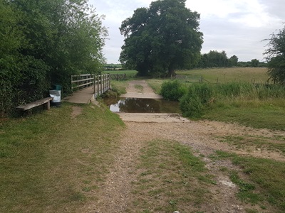
Commences at junction with county road SE of the Elms Lodge thence NE across footbridge
over River Mimram to parish boundary.
Footbridge should read 'footbridge and ford', and junction with public road at parish boundary should be noted.
|
Maintainability
This route is maintainable at the public expense because it was a footpath or bridleway existing before 30 Apr 1959.
|
|
 As part of the British Horse Society's work to record paths before
Path Extinguishment Day,
it was spotted that Dark Lane was not on the definitive map. An application to record it was made on 16 Mar 2015 based on historical evidence.
