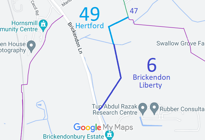
Annotated map reproduced courtesy of Googlemaps.
We need a volunteer to photograph this route for this year's Access and Riding Rights of Way Survey. It's easy - just take photographs (safely) when you use the path. Find out more!
| Paths Greenways Bridleways Tracks | ||
| PG: OBJECTS: PROMOTION: Brickendon Liberty 6 and Hertford 49 | ||
Annotated map reproduced courtesy of Googlemaps. |
This route starts on Brickendon Lane (public road) and continues northeastwards, generally northwards and eastwards to end on Hertford 47 bridleway.
We need a volunteer to photograph this route for this year's Access and Riding Rights of Way Survey. It's easy - just take photographs (safely) when you use the path. Find out more! |
| Legal History |
Definitive Statement (4 Dec 2015)
Path: [Brickendon Liberty] 6. Status: Bridleway. Definitive Map sheet: 59 Commences at junction with county road. Opposite Brickendonbury and 200 yards NW of Lodge thence NE and NW to parish boundary. Statement should refer to junction with Hertford 49 at parish boundary. Path: [Hertford] 49. Status: Bridleway.
Definitive Map sheet: 59 Statement should refer to junction with Brickendon Liberty 6 at town boundary. |
© 2021 Patchetts Green Bridleways Trust.