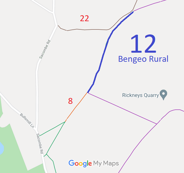
Annotated map reproduced courtesy of Googlemaps.
We need a volunteer to photograph this route for this year's Access and Riding Rights of Way Survey. It's easy - just take photographs (safely) when you use the path. Find out more!
| Paths Greenways Bridleways Tracks | ||
| PG: OBJECTS: PROMOTION: Bengeo Rural 12 and Thundridge 38 | ||
Annotated map reproduced courtesy of Googlemaps. |
This bridleway starts from Hertford 8 restricted byway and continues generally northeastwards to grid reference TL 3214 1579.
We need a volunteer to photograph this route for this year's Access and Riding Rights of Way Survey. It's easy - just take photographs (safely) when you use the path. Find out more! |
| Legal History 2 Feb 1953: Bengeo Rural 12 was recorded as a footpath on the original definitive map and statement. DM sheet DM2-21 (Herts 29 NE). 31 Dec 1977: The route was shown as a footpath on the special review draft map and statement. DM sheet SR-45. 30 Apr 1993: Application to upgrade Hertford 1, 2, 6 and 7 FP and Bengeo Rural 12 and 14 FP to bridleway. HCC reference EH/36/MOD. 5 Apr 2012: The Rickneys Quarry Public Path Creation Agreement 2012 was made by the Hertfordshire County Council and the landowner. This upgraded part of Bengeo Rural 12 FP to BW and made other changes. HCC reference EH/362/CRE. 22 Jun 2012: The Hertfordshire County Council (Hertford 6, 7 & 104 and Bengeo Rural 12) Legal Event Modification Order 2012 recorded this route as a bridleway. |
Definitive Statement (4 Dec 2015)
Path: [Bengeo Rural] 12. Status: Bridleway/Footpath. Definitive Map sheet: 45 Commences as Bridleway from the junction with Hertford RB 8 and Bengeo Rural FP 13 at TL 3196 1546 and runs NE towards the SE corner of Bardon Clumps at TL 3200 1555 then continuing outside the E edge of the wood and parallel to Bengeo Rural 22 for a total distance of approx. 385m to TL 3214 1579. Continues as Footpath to the junction with FP14 NW of Rickneys. Width: 4m between TL 3196 1546 and TL 3214 1579 Limitations: None between TL 3196 1546 and TL 3214 1579 |
© 2023 Patchetts Green Bridleways Trust.