| Paths Greenways Bridleways Tracks | ||
| PG: OBJECTS: PROMOTION: Barley 2 | ||
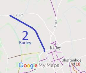
![]() Annotated map reproduced courtesy of Googlemaps. |
This route starts on London Road, Barley, and follows Horseshoe Close, then runs across fields to the B1039 Royston Road.
We need a volunteer to photograph this route for this year's Access and Riding Rights of Way Survey. It's easy - just take photographs (safely) when you use the path. Find out more! |
![]()
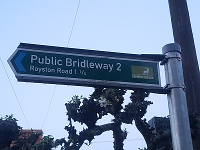
Sign at southern end |
| Legal History 1 Nov 1953: Barley 2 and 3 were recorded as footpaths on the original definitive map and statement. DM sheet DM4-10. 31 Dec 1977: Barley 2 and 3 were shown as a footpath on the special review draft map and statement. (Part of FP 2 was deleted, but this was an offshoot of the route.) DM sheet SR-8. 11 May 1979: The Hertfordshire County Council Footpath No. 2 (Parish of Barley) (Part) Public Path Extinguishment Order 1979 was made to extinguish an offshoot to Barley 2. 18 May 1979: London Gazette announcement of making the order. 13 Jan 2017: The Barley 2 Creation Agreement 2016 created the public bridleway along Horseshoe Crescent and the former line of Barley 2 FP. HCC Notice. 17 Feb 2017: The Hertfordshire County Council (Barley 2) Legal Event Modification Order 2017 added the bridleway to the definitive map and statement. |
Definitive Statement (3 Feb 2017)
Path: [Barley] 2. Status: Bridleway. Definitive Map sheet: 8 Commences from London Road (public highway) at TL 3971 3828 then NW along Horseshoe Close and NW past small spinney and stream to join B1039 Royston Road (public highway) at TL 3829 3966. Width: 3 metres between TL 3971 3828 and TL 3970 3831; 3.6 metres between TL 3970 3831 and TL 3960 3857; 4 metres between TL 3960 3857 and TL 3829 3966. Limitations: None |
© 2024 Patchetts Green Bridleways Trust. File reference: EC937.