Legal History
1 Nov 1953: Ashwell 4 was recorded as a bridleway on the original definitive map and statement.
1 Nov 1953: Bygrave 13 was recorded as a bridleway on the original definitive map and statement.
31 Dec 1977: The route was shown as a bridleway on the special review draft map and statement.
DM sheet SR-6 (TL23NE).
26 Mar 2018: Application for restricted byway status from Ashwell Road to Icknield Way.
|
Definitive Statement (4 Dec 2015)
Path: [Ashwell] 4. Status: Bridleway.
Definitive Map sheet: 6
Commences from Bygrave Road S of Chalkmans Knoll at parish boundary thence SE along
Green Lane past Cat Ditch and Mitchell Hill and under railway to join Icknield Way SW of
Harepark Farm. (Also scheduled as BR13 Bygrave).
Path: [Bygrave] 13. Status: Bridleway.
Definitive Map sheet: 6
Commences from junction Restricted Byway 14 at parish boundary thence NE along same
past Bygrave Plantation to northern tip of parish thence SE along boundary across Ashwell Road and railway to junction with Icknield Way SW of Harepark Park.
|
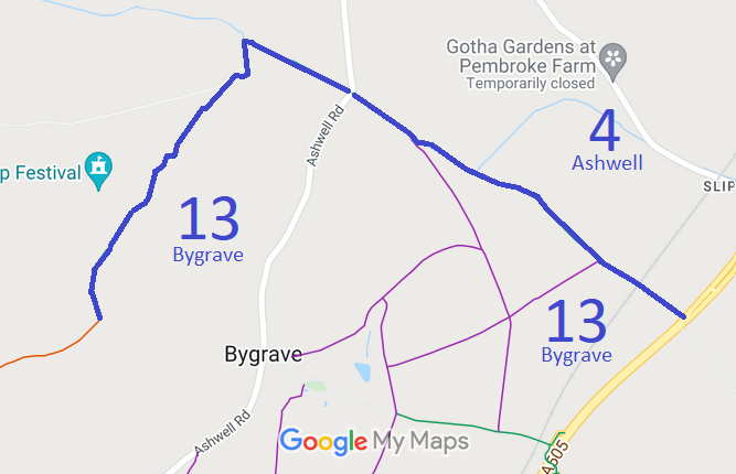
 As part of the British Horse Society's work to record paths before
Path Extinguishment Day,
it was spotted that there is substantial evidence that the route southeast of Ashwell Road should be recorded as a restricted byway. An application has been made to record the additional rights.