Paths Greenways Bridleways Tracks
 PG: OBJECTS: PROMOTION: Anstey 20 RB and 9 BW - Coltsfoot Lane AND permissive alternative to part of Anstey 20
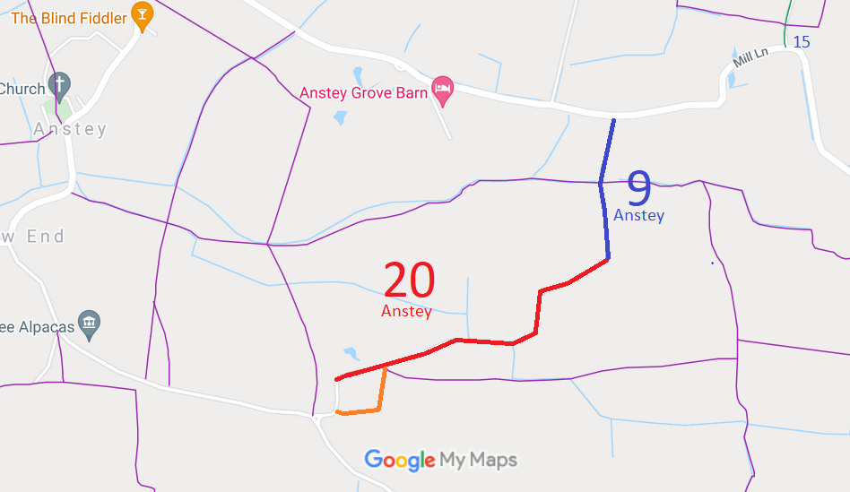
Map showing Anstey 20 restricted byway and Anstey 9 Bridleway
Annotated map reproduced courtesy of Googlemaps.
This route starts as a bridleway on Mill Lane and heads generally southwards on a wide grass margin to Coltsfoot Lane. Here it turns southeastwards as Anstey 20 restricted byway and continues on a well defined route to Anstey.

At the time of the BHS 2021 Access Survey (15 Aug 21), no gates were across the path. The council sign at the northern end was completely hidden by the hedge that had grown around it. (Subsequently cleared.)

In 2022, the landowner proposed a diversion of the western end. The proposed new route, shown in orange on the plan, is shown as 'Permissive Route' below. It is a wide track with three passing places.
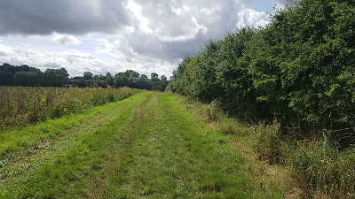
Anstey 9 from road
Anstey 9 looking S from road
Photo: Phil Wadey, 15 Aug 2021
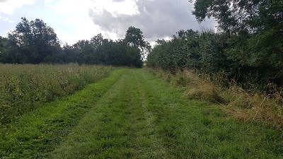
Anstey 9 looking South
Anstey 9 looking S
Photo: Phil Wadey, 15 Aug 2021
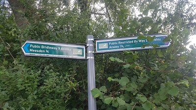
Anstey 9 sign at junction with Anstey 20
Sign at junction of Anstey 9 and 20
Photo: Phil Wadey, 15 Aug 2021
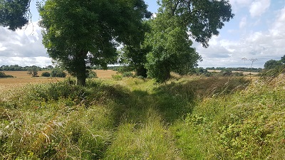
Anstey 20
View SE along Anstey 20
Photo: Phil Wadey, 15 Aug 2021
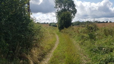
Anstey 20
View SE along Anstey 20
Photo: Phil Wadey, 15 Aug 2021
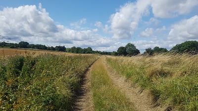
Anstey 20
View SE along Anstey 20
Photo: Phil Wadey, 15 Aug 2021
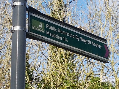
Anstey 20 sign at public road
Sign at junction of Anstey 20 and Road
Photo: Phil Wadey, 24 Feb 2023
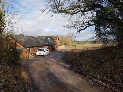
Anstey 20 from public road
Looking East from road along Anstey 20
Photo: Phil Wadey, 24 Feb 2023
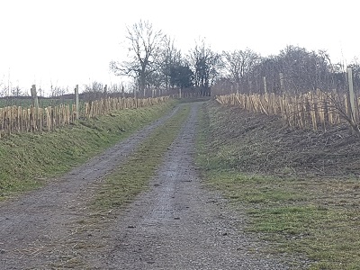
Permissive diversion, leaving old line of Anstey 20Permissive Route looking South
Photo: Phil Wadey, 24 Feb 2023
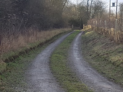
Permissive diversion, continuing southwardsPermissive Route Continuing West
Photo: Phil Wadey, 24 Feb 2023
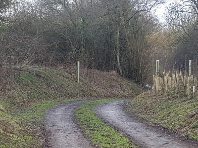
Permissive diversion, continuing westwardsPermissive Route approaching road
Photo: Phil Wadey, 24 Feb 2023

BHS As part of the British Horse Society's work to record paths before Path Extinguishment Day, it was spotted that Anstey 9 stopped at a field edge. Investigation showed that it connected to the metalled public road to the south via a green lane, Coltsfoot Lane, which was unrecorded. The evidence suggested that it had been acknowledged as a public road in the 1950s, but had vanished from the official records in the intervening years. The historical evidence looked good, so an application was made in 2013 to record the old road. The County Council agreed with the application and an order was made in 2015 and confirmed unopposed.

Legal History
8 Nov 1926: The Rural District of Buntingford (Main Roads) Order 1926, confirmed 2 May 1927, declared 4f 22yds to be a main road.
2 Feb 1953: Anstey 9 was recorded as a bridleway on the original definitive map and statement. DM sheet DM1-05.
31 Dec 1977: Anstey 9 was shown as bridleway on the special review draft map and statement. DM sheet SR-16 (TL43SW).
13 Mar 2013: Application to record Coltsfoot Lane as restricted byway. HCC reference EH/418.
10 Sep 2015: The Hertfordshire County Council (Anstey 20) Modification Order 2015 (confirmed 8 Jan 2016) added Coltsfoot Lane (Anstey 20) to the definitive map and statement.
2 May 2017: Anstey 9 BW was properly acknowledged in a s.31(6) deposit made by Manor Farm.
24 Aug 2021: Signage completely obscured at Mill Lane end reported to Hertfordshire County Council. Reference 401002203457. Subsequently cleared.
9 Aug 2022: HCC (for EHDC) consultation on proposed diversion of part of Anstey 20 RB under the Town and Country Planning Act 1990. PDW & BHS objected.
Definitive Statement (4 Dec 2015)
Path: [Anstey] 9.  Status: Bridleway.  Definitive Map sheet: 16
Commences from at the end of RB20 leading from Coltsfoot at at TL 4187 3253 thence N to join county road E of Hale Farm and near Meesden parish boundary.

Path: [Anstey] 20.  Status: Restricted Byway.  Definitive Map sheet: 16
Coltsfoot Lane. Commences from Coltsfoot (public highway) at TL 4117 3219 running along the track generally ENE for approx. 135m to a junction with FP 8 at TL 4130 3223. Continuing generally ENE then E for approx. 410m then N for approx. 115m then NE for approx. 195m to join BR9 at TL 4187 3253.
Width: Varies between 4.8m and 14.5m as shown uncoloured on the 1910 Finance Act map.
Limitations: None

© 2022 Patchetts Green Bridleways Trust. File reference: EC792, ED237.

Stats2