Patchetts Green Bridleways Trust
 PG: OBJECTS: PROMOTION: HERTSMERE: Aldenham Malt Lane
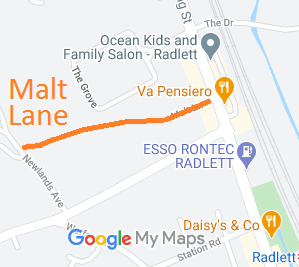
Map showing Malt Lane, Aldenham
Annotated map reproduced courtesy of Googlemaps.
This route runs from Newlands Avenue to Watling Street.

We need a volunteer to photograph this route for the Access and Riding Rights of Way Survey. It's easy - just take photographs (safely) when you use the path. Find out more!
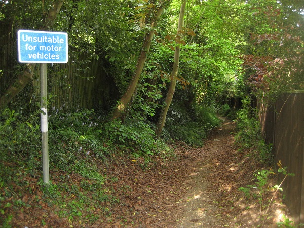
Malt Lane

Malt Lane from Newlands Avenue
Photo: Phil Wadey, 21 May 2010

BHS PGBT As part of the Patchetts Green Bridleways Trust's and British Horse Society's work to record paths before Path Extinguishment Day, it was spotted that this long-established road was not on the definitive map. An application was made to record it in 2010 and we wait for it to reach the top of the County Council's priority list.

Legal History
1839: Malt Lane was shown on the Aldenham tithe map as not subject to an apportionment.
20 Jun 1953: The route was not recorded on the original definitive map and statement.
1 Jan 2010: Application made to record route as a byway. HCC reference HTM/184.
Application Process
Path Application Certificate Direction Inv Report Order Confirmed
EC531 1 Jan 2010 HTM/184 28 May 2010        
[This route is not yet recorded on the definitive map and so there is no definitive statement.]
Maintainability
This route is maintainable at the public expense because it was a highway before 1835.

© 2024 Patchetts Green Bridleways Trust. File reference: EC531.