Legal History
20 Jun 1953: This route was recorded as Watford 16 bridleway on the original definitive map.
Map DM3-30.
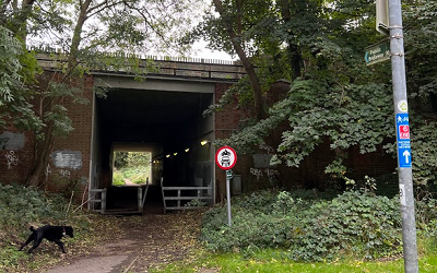
The Watford and South of St Albans - Redbourn - Kidney Wood, Luton, Special Roads (Improvements) Order 1958 diverted the 'Bridle Road' known as 'Garston Lane' to the route that uses what is now the M1 underbridge. 'Garston Lane' later became known as 'School Lane'.
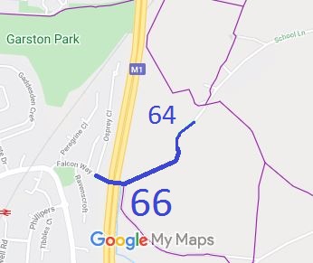
31 Dec 1977: The route was shown as bridleway Watford 16, Aldenham 66 and St Stephen 64 on the special review draft map and statement. DM sheet SR-76.
The Hertfordshire County Council (Watford 16, Aldenham 66 and Aldenham 80) Modification Order 2005 (confirmed 20 Jun 06) recorded the bridleway correctly in respect of its passage under the M1 and recorded the whole of the Aldenham length as having a width of 5m. (PINS reference FPS/M1900/7/36.)
The Hertfordshire County Council (Bridleway 66, Aldenham) (Prohibition of Use by Motor Vehicles and Equestrians) Order 2007 was proposed as a means of stopping motor cyclists (as it would enable barriers to be installed), but was not confirmed.
1 Apr 2023: The Hertsmere Borough Council (Reorganisation of Community Governance) Order 2022, made 29 Dec 2022 and coming into effect 1 Apr 2023, moved the Aldenham Parish Boundary, resulting in this way falling in the new parish of Hertsmere Meridan instead of Aldenham.
|
Definitive Statement (4 Dec 2015)
Path: [Aldenham] 66. Status: Bridleway Map Sheet: 76 and 84
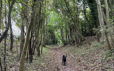
Commences at parish boundary at junction with Falcon Way on the west side of the M1 (TL 1231 0000), then east through the underpass, thence generally NE to join St. Stephen BR 64 at parish boundary (TL 1253 0012).
Width: 5 metres
Limitations: None
Path: [St Stephen] 64. Status: Bridleway Map Sheet: 76
Commences at junction with BR66 (Aldenham) at Parish boundary thence NE to junction
with county road.
|