Legal History
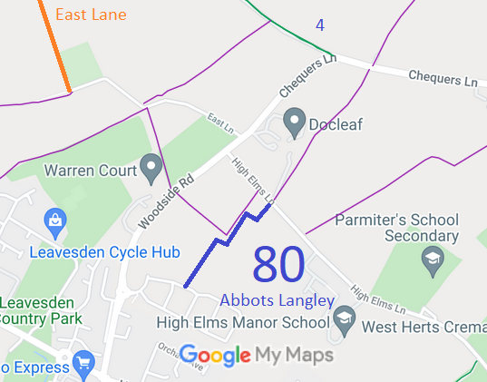
12 Aug 2016: The Woodside Road Development Public Path Creation Agreement 2016 created this bridleway. HCC reference: 3R/26.
28 Jun 2018: Landowner deposit under s.31(6) Highways Act 1980 stated route is a bridleway.
|
DRAFT Definitive Statement (12 Aug 2016)
Path: [Abbots Langley] 80 (TBC). Recorded Status: Bridleway.
A public bridleway commencing at a junction with the adopted highway at TL 1070 0173 (point A on the plan) running generally north east for approximately 135 metres to TL 1077 0184 (point B on the plan). Then generally east south east for approximately 30 metres to TL 1080 0183 (point C on the plan). Then generally north north east for approximately 95 metres to TL 1084 0191 (point D on the plan). Then generally south east approximately 25 metres to TL 1086 0190 (point E on the plan). Then generally north east for approximately 55 metres to TL 1090 0193 (point F on the plan) to a junction with High Elms Lane (public road).
Width: 4 metres.
Limitations: None
|