Paths Greenways Bridleways Tracks
 PG: OBJECTS: PROMOTION: Abbots Langley East Lane
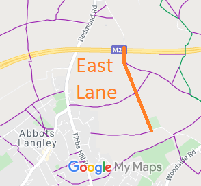
Map showing East Lane, Abbots Langley
Annotated map reproduced courtesy of Googlemaps.
This route is a part of East Lane that is stopped to motor traffic. It remains open to walkers, riders and cyclists.

At the time of the 2014 Access Survey (28 Jul 14), no gates were across the path.

We need a volunteer to photograph this route for the Access and Riding Rights of Way Survey as our last survey was more than ten years ago. It's easy - just take photographs (safely) when you use the path. Find out more!
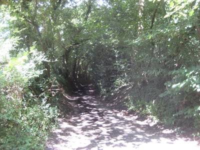
Photograph of East Lane, Abbots Langley, heading north
From southern end, looking northwards
Photo: Phil Wadey, 28 Jul 2014
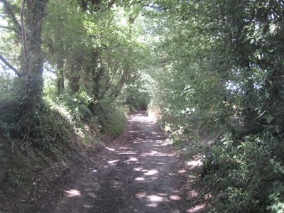
Photograph of East Lane, Abbots Langley, heading north
Continuing northwards
Photo: Phil Wadey, 28 Jul 2014
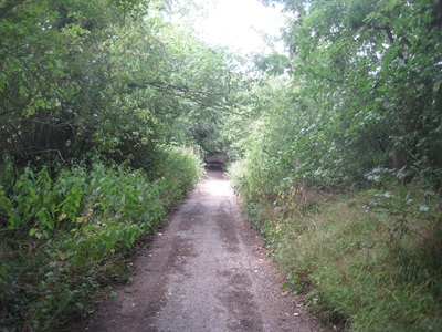
Photograph of East Lane, Abbots Langley, heading north
Continuing northwards
Photo: Phil Wadey, 28 Jul 2014
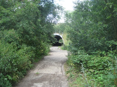
Photograph of East Lane, Abbots Langley, heading north
Continuing northwards
Photo: Phil Wadey, 28 Jul 2014
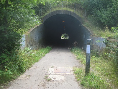
Photograph of East Lane, Abbots Langley, heading north
From northern end, looking southwards
Photo: Phil Wadey, 28 Jul 2014

BHS PGBT As part of the British Horse Society's and Patchetts Green Bridleways Trust's work to record paths before Path Extinguishment Day, it was spotted that this old road had not been recorded on the definitive map. The historical evidence showed a continuous route, so an application was made in 2013 to record it.

Legal History
1938: The route is shown as unclassified road on the Hertfordshire County Council ROW survey. Map St Albans 15.
20 Jun 1953: The route was not recorded on the original definitive map and statement. DM sheets DM3-29 and DM3-30.
31 Dec 1977: The route was not shown on the special review draft map and statement. DM sheet SR-76.
2 May 2006: NERC exemption s.67(2)(b) as route not on DM but was on LOS.
16 Jul 2010: Consultation on The Hertfordshire (8U72 East Lane, Abbots Langley) (Prohibition of Driving Motor Vehicles and Horse Drawn Vehicles) Order 2010 (draft) by the County Council.
25 Mar 2011: The Hertfordshire (8U72 East Lane, Abbots Langley) (Prohibition of Driving Motor Vehicles and Horse Drawn Vehicles) Order 2010 was made and came into force, effectively prohibiting traffic that can't use a bridleway.
9 Apr 2013: Application for byway. HCC reference 3R/81.
Application Process
Path Application Certificate Direction Inv Report Order Confirmed
EC326 9 Apr 2013 3R/81 31 May 2019        
[This route is not yet recorded and so there is no definitive statement.]
Maintainability
This route is maintainable at the public expense because it was a highway before 1835.

© 2024-2026 Patchetts Green Bridleways Trust. File reference: EC326. HCC reference: 3R/81.

Stats2